The Chinese Communist Party’s Ministry of Natural Resources published a new “standard map of China” on Monday, labeling nearly the entire South China Sea, the nation of Taiwan, and large swathes of India under Chinese rule.
Beijing typically releases an updated official version of the map of the country every year. It has regularly outraged its neighbors by pushing China’s borders far beyond where they sit in real life, slicing off parts of other countries and declaring them Chinese territory.
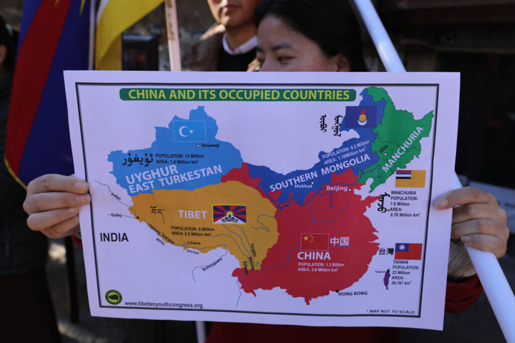
The Chinese government has, on multiple occasions, attempted to rename parts of India with Mandarin-language names and often refers to northern India as “South Tibet.” Tibet itself is an occupied territory, where most residents have no ethnic or cultural ties to the dominant Han people in the Communist Party and reject attempts to exterminate their identity.
In the South China Sea, China illegally claims territory belonging to Brunei, Vietnam, the Philippines, and Malaysia. It also falsely claims the entire nation of Taiwan as a rogue “province,” along with its maritime territory and the waters off of Natuna Island, Indonesia. In 2016, the Permanent Court of Arbitration at the Hague ruled, in a case brought to it by the government of the Philippines, that China’s claims in the South China Sea were all illegitimate. Beijing has proceeded to ignore that ruling for the better part of a decade, as the court has no enforcement mechanism and the states that rightfully own that territory have much smaller militaries than China.
RELATED: HIGH-STAKES WATER GUN FIGHT! China Warship Fires Water Cannon at Philippine Coast Guard Vessel
China Coast Guard via Storyful
China has regularly used a marking called the “nine-dash line” to cut into other nations’ territory in the South China Sea. India’s World Is One News (WION) network observed that the 2023 “standard map” introduces a new “ten-dash line,” seizing even more foreign territory.
On land, China falsely claims a significant portion of northern India as “South Tibet.” The 2023 “standard map” included, within Chinese borders, the entire state of Arunachal Pradesh and the territory of Aksai Chin.
The 2023 edition of China’s standard map was officially released on Monday and launched on the website of the standard map service hosted by the Ministry of Natural Resources. This map is compiled based on the drawing method of national boundaries of China and various countries… pic.twitter.com/bmtriz2Yqe
— Global Times (@globaltimesnews) August 28, 2023
The regime newspaper China Daily explained the publication of the new map was timed to correspond with “National Mapping Awareness Publicity Week,” a government holiday meant to celebrate Communist Party officials who specialize in cartography. The head planner of the Natural Resources Ministry, Wu Wenzhong, told the state newspaper that publishing the map of China’s borders is the first step in developing more advanced digital resources that document, in detail, the terrain in every area.
“The next step will be to accelerate the application of geographic information data such as digital maps and navigation and positioning in the development of the digital economy,” Wu explained, “such as location-based services, precision agriculture, platform economy and intelligent connected vehicles.”
Such services would appear to be especially important in the difficult mountainous terrain that straddles the legitimate border between China and India. The “Line of Actual Control” (LAC) — the border as India accepts it — cuts through the Himalayas and presents severe challenges in both navigation and developing accurate maps of the area.
The Indian government forcefully condemned the loss of its territory on the new “standard” map in statements on Tuesday. A spokesman for the Indian External Affairs Ministry, Arindam Bagchi, issued a statement flatly rejecting the claims.
“This is not the first time China has made such an attempt. We reject this outright,” Bagchi said. “Arunachal Pradesh is, has been and will always be an integral and inalienable part of India. Attempts to assign invented names will not alter this reality.”
Bagchi later published a separate statement confirming that the External Affairs Ministry had “lodged a strong protest through diplomatic channels” with the Communist Party.

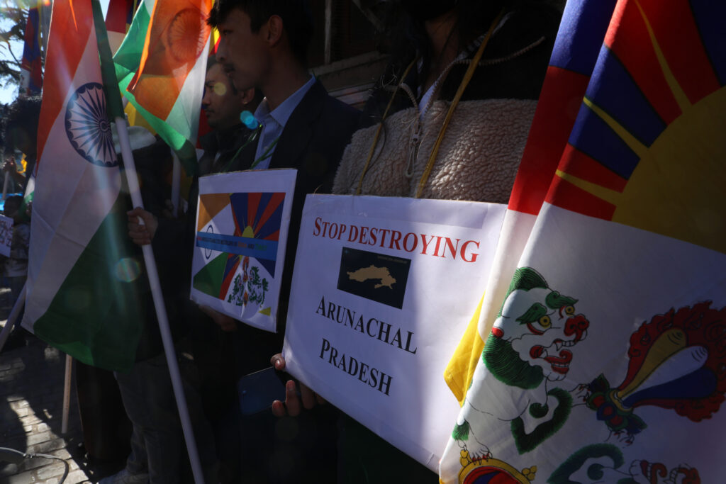
Tibetan NGOs and local Indians take part during a demonstration in Dharamshala, India, to protest against the recent Arunachal Pradesh border incursion by the Chinese Peoples Liberation Army on December 15, 2022. (Sanjay Baid/ Eyepix Group/Future Publishing via Getty Images)
The External Affairs minister, S. Jaishankar, called the map “absurd” on Tuesday.
“China has put out maps with territories not theirs. Old habit,” Jaishankar told India’s NDTV. “Putting out maps with parts in India doesn’t change anything. Our government is very clear about territory. Making absurd claims does not make other people’s territories yours.”
China has made multiple bombastic declarations claiming Indian territory in recent memory. In early 2022, the Communist Party’s Ministry of Civil Affairs announced 15 new names for places in Arunachal Pradesh. Arunachal Pradesh itself, it claimed, was now “Zangnan” or “South Tibet” (the Chinese Communist Party has also tried to rename Tibet with the Han name “Xizang.”)
“It is a legitimate move and China’s sovereign right to give them standardized names. More standardized place names in the region will be announced in the future,” a Chinese “expert” told the state-run Global Times newspaper at the time.
In April, the Chinese government rolled out a new set of Mandarin-language names for more locations in “Zangnan” and outrageously claimed the Indian state was “China’s territory since ancient times.” New Delhi reacted with very similar statements to those published on Tuesday.
“This is not the first time China has made such an attempt. We reject this outright,” Bagchi, the External Affairs Ministry spokesman, said at the time.

Tibetan NGOs and local Indians take part during a demonstration in Dharamshala, India, to protest against the recent Arunachal Pradesh border incursion by the Chinese Peoples Liberation Army on December 15, 2022. (Sanjay Baid/ Eyepix Group/Future Publishing via Getty Images)
China’s efforts to seize Indian territory have not stopped at theoretical renamings. In June 2020, a large contingent of Chinese People’s Liberation Army (PLA) soldiers illegally crossed into India’s Ladakh region, another area of the LAC. The soldiers reportedly set up tents in India and, when confronted by Indian soldiers, attacked them. At the time, Beijing and New Delhi maintained an agreement not to equip border soldiers with firearms, so the gruesome Galwan Valley Battle, as it came to be known, was fought with rudimentary weapons such as rocks and sticks wrapped in barbed wire. The Indian military confirmed 20 deaths in the battle, while China refused, for months, to release any information on casualties. Indian government sources claimed the Chinese lost twice the number of soldiers in the fight.
More recently, hundreds of Chinese soldiers poured into Arunachal Pradesh in December, attempting to establish a position within India using “spiked clubs with nails on them, monkey fists and taser guns,” according to Indian media reports. In another battle not involving firearms, Indian soldiers fought back and forced the Chinese to leave the region. No deaths were reported in the clash on either side.
While in an alliance with China through the BRICS (Brazil, Russia, India, China, South Africa) coalition, the Indian government has asserted publicly that it does not maintain cordial relations with Beijing as a result of the border dispute.
“We have agreements with China going back to the 1990s which prohibits bringing mass troops in the border area. They have disregarded that,” Jaishankar, the external affairs minister, lamented in August 2022. “You know what happened in the Galwan Valley. That problem has not been resolved and that has been clearly casting a shadow.”
“They are our neighbors. Everybody wants to get along with their neighbor. In personal life and country-wise as well. But everybody wants to get along with on reasonable terms. I must respect you. You must respect me,” he asserted.
In February, Jaishankar named China as the only major world power India did not get along with.
“India’s relationship with major powers is good. China is an exception,” he explained, continuing, “because it violated agreements that we’ve had and has a posture at the border and, as a result, we have a counter posture.”


